|
Holidays on the Turquoise Coast |
|||
| Hardly noticed lycian city |
|
||
| Kitanaura (Sarayçik) | |||
| The name is controversial | |||
 |
|
||
| The Roman Baths | |||
|
Kitanaura is an
ancient Lycian city, in the mountains above Kemer. |
|||
|
|
|||
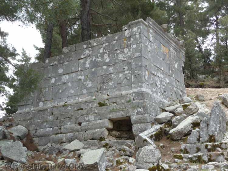
| Heroon or Mausoleum | |||
|
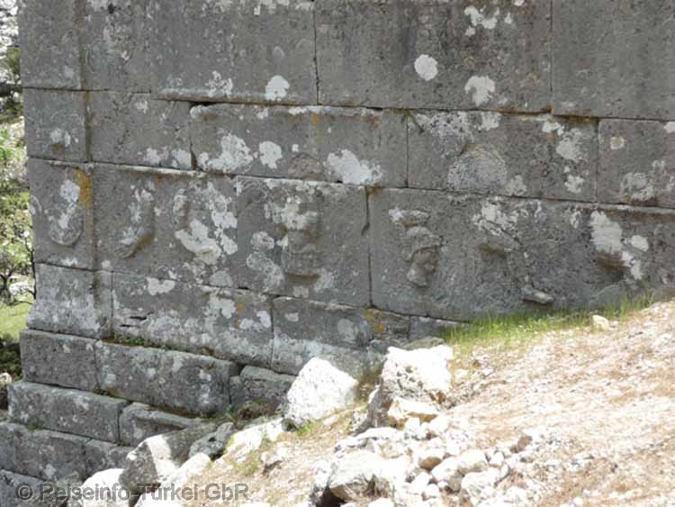
Directly at the road there is a quite well preserved building, which is called a heroon or mausoleum. A little below the street level the building shows a kind of frieze. The rectangular stones used in this row of walls are decorated with raised figures of weapons, equipment and limbs. |
|||
|
|
|||
| Figures on the Heroon | |||
 |
|||
|
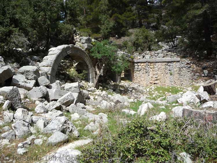
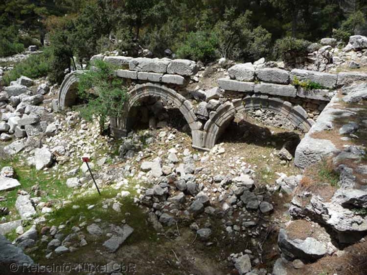
The Roman Baths |
|||
|
Also at the level of the present road is the access to the thermal baths, signposted as "Bad". Three today free-standing round arches have survived the times as well as an opposite wall part with a round arch. Next to the Heroon, the Therme is the best preserved building in the city. |
|||
|
The baths were
built in the 3rd century AD and were in operation until the 14th
century. Even after a fire in the 6th century there were no
major structural changes. |
|||
 |
|||
| At the Acropolis | |||
|
|
|||
|
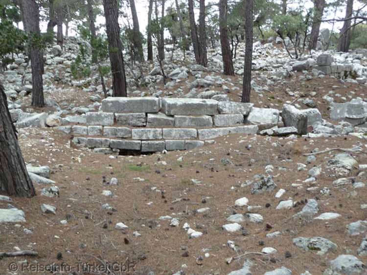
Although the city has been archaeologically explored by the University of Antalya, it has not been excavated. The area of the Acropolis has buildings hardly recognizable to the layman. The remains of the buildings give the impression of lasting human influence. Hardly one stone above the earth's surface lies on top of another. The Bouleuterion and the Byzantine basilica can only be identified with prior knowledge. |
|||
|
|
|||
| The main gate on the west side | |||
|
|
|||
| Rock niches at the main gate | |||
|
Die Mauern und Gebäudereste stammen z.T. noch aus hellenistischer, lykischer, römischer und byzantinischer Zeit. Die Stadtmauern sind zum großen Teil in den Fundamenten erhalten geblieben. Sie umschlossen die Akropolis. Die Mauern der ersten Bauphase sind in typischer Zyklopbauweise erstellt. In die römische Bauphase sind die Mauerteile einzuordnen, deren Steine behauen waren und eine rechteckige Form mit an den Fügekanten begradigte Ränder aufweisen. |
|||
 |
|||
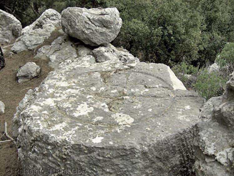
| The Sunstone | |||
|
Kitanaura can be reached via the old
connecting road from Antalya to Kumluça. In Antalya you drive
out of the city past the large Migroscenter in the direction of
the sea. About 500 m before this road by the sea meets the D400
again, i.e. about 5.5 km after the Migroscenter, the road to
Altınyaka is signposted on the right. The scenic road now leads
into the Taurus Mountains and climbs up to approx. 1300 m
altitude. After about 38 km you reach the turn-off to Kitanaura
on the right hand side, from there it is still a good 13 km to
the first sarcophagi and the hill with the acropolis of
Kitanaura. Unfortunately Kitanaura is not signposted with brown
signs as usual. Coming from Kumluça, turn left about 8 km after the village Altınyaka. After another 6 km you have reached the ruins of Kitanaura also from this direction. But Kitanaura can also be reached from Kemer. If you are coming from Kemer, turn off at the bridge between the exits to Camyuva and Kiriş to Camyuva and drive along the river towards the mountains at the next opportunity. Soon after Kuzdere the quite well constructed road leads into a wild romantic gorge and further, always uphill, via the villages Gedelma and Ovacik past the Hotel Gül Mountain to the connecting road Antalya - Kumluça. Turn to the right. After 1 km you reach the turn-off (left) to Kitanaura. Turn left in the direction of Altınyaka, after 10 km you will reach the turnoff to Kitanaura on the right, as described from Kumluça. |
|||
|
|
|||